Scenic Rim Walking Trail
Cherry Tree Bay
Breathe in the fresh air and discover beautiful Cooktown on foot - The Scenic Rim walk consists of several sections each with unique attractions.
Captain Cook’s statue in the Bicentennial Park (opposite the Police Station in Charlotte Street) has been chosen as the starting point, however, the trail may be commenced or completed at any point along the route and may be walked in either direction.
Cooktown’s diverse habitats, each with their own special features and species, provide a rich variety of flora and fauna, all within easy walking distance from the town centre.
These range from the mangrove-lined banks of the Endeavour River to the tropical rainforest of Mount Cook National Park.
Walk through the historic Cooktown Cemetery and Botanic Gardens to the rocky headland between Finch Bay and Cherry Tree Bay. Enjoy the sand dunes and beaches of this rugged coastline.
A hat should be worn at all times and water carried especially on walks longer than one hour.
Avoid insect bites (mosquitoes and sand flies) by applying repellent and wearing long pants/sleeves.
Sections of the trail / track require that sturdy footwear be worn.
Some sections may be affected by tidal movement and can become dangerous and or impassable.
Beware
Estuarine crocodiles can occur in all coastal waterways.
Box jelly fish capable of causing fatalities may be present near beaches between November and May.
Swimming in the sea during these months is not advisable.
Section 1: James Cook Statue to Hogg Street (1.2km)
Commencing at James Cook statue, the Scenic Rim Walking Trail follows Adelaide Street along the Endeavour River foreshore to the corner of Hogg Street (behind the bakery).
The estuarine environment forms a complex breeding ground for different forms of wildlife. The tidal salt flats, arel the habitat of many life forms such as crabs, insects, lizards, and birds.

- Cooktown Bay

Section 2: Hogg Street to Cooktown Cemetery (1.2km)
Here the route becomes an ungraded track and turns right past an old rail tender. Before reaching Ticklebelly salt flats (50m), the trail turns left through some trees onto the old Cooktown to Laura railway line.
Mangroves can be seen from both sides of the railway line, and in places are complemented by an almost 360 degree view of the surrounding area.
You will encounter an old railway siding that has become a series of mangrove ponds, with a saltwater lagoon surrounded by salt grasses and crab mounds.
The trail follows the railway line. It crosses two bridged tidal creeks and continues along the line until it crosses the salt flats to the back of the Cemetery. A beautiful tea-tree forest merges with the salt marsh at the tidal limit. After crossing a number of shallow trenches the trail reaches a T-junction. The right track leads past the Chinese Shrine to the main part of the Cemetery.
The left track leads through the cemetery to the main entrance on Charlotte Street. Here much of the local history, tragedies, triumphs and mysteries of Cooktown’s past lies buried. The oldest identifiable graves are from 1874. Mary Watson and her infant son, Ferrier, are interred here. Their servant, Ah Sam, lies in an unmarked grave.
Section 3: Cemetery to Mt Cook National Park, via Racecourse Road (4.6km)
From the front entrance of the Cemetery, the Scenic Rim Walking Trail turns right onto Charlotte Street and then left onto Racecourse Road. At the end of Racecourse Rd, turn left towards Hope Street, then right onto Ida Street and right onto May Street. At the school, turn left onto Charles Street past a section of sealed road in front of Cooktown State School. It continues towards Mt Cook, then swings left onto Melaleuca Street shortly after crossing the top end of Alligator Creek. About 300 metres further along this unsealed road, the Mt Cook National Park sign (on the right) marks where the old Mt Cook trail once started. Continue on for another 1km until you reach the car park at the foot of Mount Cook.
Section 4: Mt Cook Summit - Allow 3-4 Hours Return (6km)
Solid footwear is required. Walkers should be reasonably fit and have previous bush walking experience.
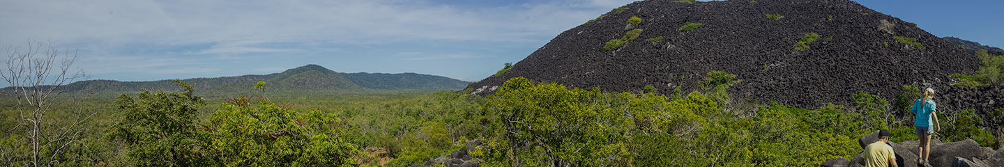
The track is steep and narrow. It passes through open forest on the lower reaches of Mt Cook, until it reaches the rainforest. Up through the dim rainforest light, it weaves its way past thorny vines and around walls of buttress roots, across the forest floor with leaves, fruit and flowers fallen from the canopy high overhead. Occasionally, you will catch a glimpse of Cooktown, Grassy Hill and Finch Bay far below. Once at the summit, there is a viewing platform with stunning views over Quarantine Bay.

- Finch Bay

Section 5: Finch Bay to Cherry Tree Bay (0.9km)
The track winds its way from the northern end of Finch Bay around the rocky headland, then descends to the small secluded beach at Cherry Tree Bay offering some magnificent views along the way. Sometimes fish and turtles can be seen swimming in the Bay. On rare occasions dugong can be spotted playing. This section is narrow and steep in parts with many rock steps so that sturdy footwear is recommended. A reasonable degree of fitness is required.
Section 6: Finch Bay to the Botanic Gardens and Nature’s Powerhouse (1.7km)
From the northern end of Finch Bay, a constructed walking track leads to the beautiful botanic gardens and to Natures Powerhouse, a gallery and interpretive centre. Here you can wonder through this unique display of reptiles from the area, browse the many titles in the book and gift store, (many of the books written by local authors) or enjoy morning tea, lunch or afternoon tea.
The Botanic Gardens
In 1878, 154 acres were set aside for the establishment of a Botanical Garden. Today, the Garden Reserve extends from the rocky coast of Cherry Tree Bay to Alligator Creek at Finch Bay, along the creek to Hogg Street, Garden Street, in a north-north-easterly line that runs back to the rocks.
Section 7: Cherry Tree Bay to Grassy Hill (0.8km)
The track leads from Cherry Tree Bay beach through open forest before it joins an old 4WD track to emerge onto the Grassy Hill Road. Turn right at the T– junction and continue to the top of Grassy Hill which offers a magnificent 360-degree view of Cooktown. Or if you wish to return directly to the Endeavour River foreshore, turn left and follow the bitumen road downhill, turning right at Green Street.
Section 8: Grassy Hill to James Cook Statue (1.9km)
From the top of Grassy Hill it is down hill all the way back to the Endeavour River foreshore.
Follow Grassy Hill Road down past Baird Road, right down Hope Street, then turn right into Green Street. This will bring you back to the Post Office and Old Council Chambers, then turn right along Charlotte Street.