Cedar Bay North Walk
Cedar Bay
This walk is only recommended for self reliant walkers with extensive bushwalking experience.
The trail to Cedar Bay starts at Home Rule Rainforest Lodge and walkers are requested to stop at the lodge for directions to the starting point. The strenuous, 28 kilometre return walk takes 6 to 8 hours walking time each way. It is essential to start the walk in the morning, the earlier the better, to arrive at the bay before nightfall. Because the trail is not well-used some sections are indistinct, so make sure you don’t lose sight of the orange markers. It is rough undulating country, so wear strong hiking boots and protective clothing. Carry everything you need, but take lightweight gear as it is a long way to carry a heavy pack.
Home Rule to Slaty Creek - 1¾ hours
The walk starts on an old logging track and heads straight into the rainforest. The track splits a few minutes into the walk – go right. Shortly, the track splits again – go left. A few more minutes brings you to Wallaby Creek. About 10 minutes beyond Wallaby Creek the track forks again – go left.
After the track crosses another small creek it swings north, climbing straight to the top of a moderately steep ridge. From this point it swings east at ninety degrees and starts to descend, passing amongst large rainforest trees, tree ferns and Licuala palms.
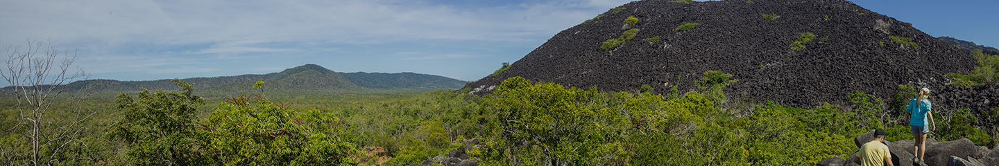
About 1 hour into the walk you come to a narrow gully spanned by two thin metal pipes. From here a narrow trail continues on from the old logging track. The trail heads north to Slaty Creek, about 1¾ hours from Home Rule.
Slaty Creek to Black Snake Rocks - 2½ hours
After crossing Slaty Creek the trail swings east and follows the creek for about 1·5 kilometres to the junction of Slaty and Granite Creeks, where there is an excellent campsite. Beyond the junction the trail meanders through forest beside Granite Creek for a while and then gets rougher as it winds through scattered granite boulders, crossing a few small creeks. Eventually the trail scales a slope covered with huge granite boulders and arrives at Black Snake Rocks.
Black Snake Rocks is an open area, with a creek and a good campsite, but (obviously) be aware that snakes do bask on the rocks. The creek next to the campsite is the last reliable water source before Ashwell Creek at Cedar Bay.
Black Snake Rocks to Cedar Bay - 2½ hours
Beyond the campsite the trail meanders across a flat densely forested plateau. This area was extensively mined in the past and remnants of miners’ activities crop up regularly. Most noticeable are water diverting channels dug by tin miners early last century. The trail runs alongside a channel just before it reaches a clearing crisscrossed with trenches full of ferns, a trap for unwary legs.
On the eastern side of the clearing scraps of corrugated iron and abandoned cooking implements mark where the trail re-enters the forest. The trail continues alongside a smaller channel before swinging southeast along a broad ridge to the top of the range overlooking Cedar Bay. Unfortunately, there is no position where you can get more than a tantalising glimpse of the coast. From here the trail descends a spur to the bay, another 1½ to 2 hours away.
The steep descent to the bay is eased by a set of switchbacks carved into the hillside, another legacy of the mining era. Supplies were transported to the mines by packhorse, and the ore removed by return journey. It is difficult to imagine a horse climbing these steep inclines, let alone carrying a load. Further down, the switchbacks end and the trail straightens as it approaches the bottom of the coastal range.
Ashwell Creek is only a short distance from the base of the range. Fill your water containers here, as the water in the creeks near the ocean is brackish (and may conceal crocodiles).
Cross the creek, swing left and follow the trail to the beach. There are remnants of Cedar Bay Bill’s hut on the southern bank of Ashwell Creek near the crossing. The trail emerges at the northern end of the beach amongst a grove of pandanus palms next to Cedar Bay Bill’s monument, which bears the epitaph “Strange to the world, he wore a bashful look – the sea and shore his study, nature his book”.
Cedar Bay Bill was a tin miner, famous for accepting and befriending a utopian hippy community that attempted to flee society and build a Shangrila at Cedar Bay in the early 1970s. Whatever it was they believed in didn’t suit the government of the day, who sent select law enforcers to destroy the campsites and disband the community, an action that annoyed all but the most conservative citizens of the time. Bill retained his miners lease until his death in 1987, and the story of the commune has entered folkloric mythology. This has given the bay a special allure, and many walkers come specifically to pay homage to the site.
Although it is a national park, Cedar Bay is still a remote tropical paradise with a 3 kilometre palm fringed beach. A stroll along the beach reveals sheltered campsites – just camp well away from the swamps and be wary of falling coconuts.
This is a tranquil place where campers can now contemplate the irrelevance of time and appreciate the moment without fear of government gunboats, but do remember, you need a camping permit and park rules state that there can be no fishing or collecting within the park.
Specific Features: Beautiful tropical rainforest, rugged mountains and a palm fringed beach.
Mangkalba (Cedar Bay) is the traditional country of the Eastern Kuku Yalanji Aboriginal people, whose country extends along the coast to Mossman. Cedar Bay National Park was a major turtle hunting area and contains important cultural sites including the murabaymba (canoe), ngawaia (turtle) and ngiwa (saltwater eel) story sites.
Difficulty Level: Strenuous
Distance: 28 Kilometre (Return)
Duration: 6-8 hours each way
Access: Self Guided – (*Permit required)
- This track begins on the private property of the Home Rule Rainforest Lodge. The lodge managers allow access via their property and provide detailed advice to walkers.
- Water Taxi - Cedar Bay Transfers –
Either one way for bushwalkers not interested in the return leg of the walking track or Return - get delivered to or collected from Cedar Bay on your nominated day. Ph: 07 4060 8252 - Alternate Route – Gap Creek Track. Only for the very experienced bush walker and should not be attempted when heavy rain has fallen or is forecast. It crosses several creeks and steep sections can become slippery in wet weather. For details and advice contact Queensland Parks and Wildlife Service or visit www.derm.qld.gov.au/parks/cedar-bay/about.html.
Facilities: No facilities
- *Bush camping is permitted in the park, but a camping permit must be obtained two weeks in advance from the Queensland Parks and Wildlife Service office in Mossman: 07 4098 2188, Cooktown: 07 4069 5777 or Cairns: 07 4046 6600.
- Overnight camping at the Home Rule Rainforest Lodge is allowed by prior arrangement with the owners, allowing walkers an early morning start. Phone 07 4060-3925.
Trail Management Contact: Queensland Parks and Wildlife Service - Mossman: 07 4098 2188, Cooktown: 07 4069 5777 or Cairns: 07 4046 6600.
- Map of Cedar Bay walking trail courtesy Footloose publications